| Porthpean Sailing Club |
|
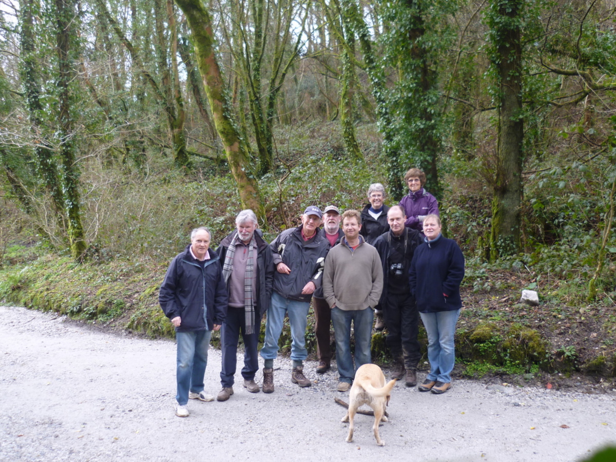
Only nine people and a dog turned up for what turned out to be a very pleasant walk in Luxulyan Woods. We had a similar walk several years ago but that time approached Luxulyan from the Pontsmill direction. Our walks have always been held on a Sunday and maybe holding it on a Saturday had some bearing on the low turn out. The weather, however, turned out to be a bonus; this week we have distinctly had a spring feeling in the air. For a start we’ve had more sun than normal, and the cold easterly winds have slowly been fading away allowing the temperature to creep upwards although some westerly winds brought us some rain, so for the walk we had quite mild weather and the rain during the week hadn’t made the ground too wet. I’m writing this on the following day, Sunday, and the prospect of going walking today would be only for the really keen ones. A fresh to strong easterly wind, together with rain in the night has made today, Sunday, a very bleak cold day with the possibilty of snow later on, so we certainly scored by having the walk yesterday. I’m not too sure who is responsible for the upkeep of Luxulyan woods but quite a lot of work in improving the pathways have been carried out since I last walked there and I would think that in about 6-8 weeks time when all the fresh greenery is out it will be a very pleasant walk indeed. Paddy & I felt a bit out of place wearing only trainers on our feet, but managed to escape the worst of any muddy areas by slight deviations off the track. Nick Haskin’s dog had the time of her life, running everywhere and taking any and every opportunity to go swimming in what surely must be bitterly cold water!! There is a lot of history involving this area and from the early 1800s was highly developed by local industry. I’m sure that they didn’t have any problems with planning departments back then. After having walked through the woods and valley, I found quite an interesting article on the area on Wikepedia, which I have copied over to here. The Luxulyan Valley (Cornish: Glynn Gwernan, meaning alder tree valley) is the steep sided and thickly wooded valley of the River Par, situated in the south east of Cornwall, England, UK. It contains a major concentration of early 19th century industrial remains, and was designated as part of a World Heritage Site in 2006. The valley stretches south-east from the village of Luxulyan 50.390°N 4.744°WCoordinates: 50.390°N 4.744°W. It reaches as far as the edge of the built-up area around the town of St Blazey and the port of Par, a distance of some 5 km. It lies within the civil parishes of Luxulyan, Lanliveryand Tywardreath, and is one of the areas (designated A8i in the original nomination) of the larger, but discontinuous, Cornwall and West Devon Mining Landscape World Heritage Site. Most of the industrial remains in the valley are the results of the endeavours of Joseph Treffry (1782–1850). Copper mining was booming in the area during the early 19th century, and Treffry was the owner of Fowey Consols mine, one of the deepest, richest and most important of the Cornish copper mines. The mine was situated to the east of the southern end of the Luxulyan Valley proper, and its site is part of the designated World Heritage Site. At its peak it was worked by six steam engines and 17 water wheels. In the late 1820s, Treffry built the port of Par Harbour. He then linked this to Pontsmill, at the southern end of the valley, by means of the Par Canal. A mineral tramway connected the canal head to the mine. A second tramway followed in 1835, via aninclined plane, a flat route along the eastern lip of the valley, and the major Treffry Viaduct across the valley to Luxulyan. This second route served two major purposes, as it enabled Treffry to develop Carbeans and Colcerrow granite quarries in the upper valley, and was also used by a leat carrying water to supply the mine at Fowey Consols. Two further granite quarries, known as Rock Mill and Orchard, operated lower down in the valley. In 1870 these were linked to Pontsmill by a third tramway along the valley floor. The 1835 tramway eventually became part of the Cornwall Minerals Railway which linked the English Channel ports of Par and Fowey with the china clay workings of central Cornwall, and to the Atlantic port of Newquay. As part of this process, the section of the route between Pontsmill and Luxulyan, with its incline and flat sections ideal for animal haulage, was replaced with a more gradually climbing route through the valley itself, more suited to locomotive haulage. The newer route is still in use, as part of theAtlantic Coast Line, and passes beneath the spans of the Treffry Viaduct that carried its predecessor. The older tramway routes remained in use to serve the various granite quarries until the early 20th century. The last stone came from Carbeans in 1933 but a few sections of Treffry's rails can still be found. The thickly-wooded terrain of the Luxulyan Valley also played a major part in the early tin mining industry of Cornwall. The woods were important for making the charcoal that was needed in large quantities for smelting tin from the rich alluvial deposits on the moors to the northwest. Charcoal-burning platforms are to be found close to nearby Prideaux Castle. |